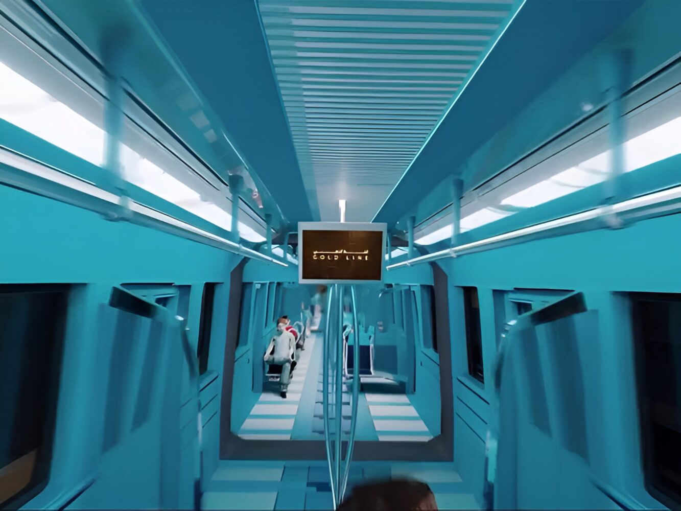
Dubai’s metro system is preparing for its largest single expansion since it opened in 2009. On 22 April 2026 the Roads and Transport Authority confirmed the full details of the new Gold Line, a 42-kilometre route that will run entirely underground and serve as the first subterranean metro corridor in the emirate. With an estimated cost of Dh34 billion, the project shifts the city’s long-term transport strategy away from further coastal extensions and toward the rapidly growing inland residential districts that have developed far beyond the reach of the existing Red and Green lines.
The route and stations
According to the newly released Rail Network Plan 2032 map, the Gold Line begins at Al Ghubaiba in historic Bur Dubai and travels in a diagonal southeast direction across the city. It passes through Al Satwa, City Walk and Business Bay before continuing into the newer growth corridors of Mohammed bin Rashid City, Nad Al Sheba, Mohammed bin Rashid Gardens and Meydan. From there the line heads toward Al Barsha South, Jumeirah Village Circle, Dubai Production City and Dubai Hills, finally terminating at Jumeirah Golf Estates.
The line will include 18 stations spread across 15 strategic locations. While exact station names have not all been finalised, the route is designed to serve a mix of older urban neighbourhoods and high-density master developments. Planners have positioned the corridor to support more than 55 major real estate projects already under way or planned in these areas. At its deepest points the tunnels will reach 40 metres underground, creating a tunnel network reportedly twice the length of the current Dubai Metro system.
Interchanges and network integration
One of the main purposes of the Gold Line is to relieve pressure on the existing Red Line, particularly its busiest central section between BurJuman and Business Bay. The new route will intersect the Green Line at Al Ghubaiba and BurJuman, and connect with the Red Line at three points: BurJuman, Business Bay and Jumeirah Golf Estates. These interchanges are intended to redistribute passenger flows more evenly rather than forcing everything through the original north-south Red Line corridor.
The design also looks beyond the metro itself. Interchange stations at Meydan and Jumeirah Golf Estates will link directly to Etihad Rail, allowing smoother transitions between Dubai’s urban system and the national rail network that is gradually expanding across the UAE. A separate high-speed rail corridor is referenced on the map running from Ras Al Khor toward areas beyond Expo City, although authorities have released no further technical or timeline details for that component yet.
Timeline and technical plans
Construction is expected to begin between 2027 and 2028, with the full line scheduled to open on 9 September 2032 — exactly 23 years after the Dubai Metro first started service. The project will introduce next-generation rolling stock and upgraded signalling systems capable of supporting higher passenger capacity and shorter headways, although final specifications have not been made public. By the time it reaches full operation beyond 2040, officials project daily ridership could reach 465,000 passengers.
Why the Gold Line now
The timing is closely tied to the Dubai 2040 Urban Master Plan, which forecasts the emirate’s population rising to around 5.8 million over the next two decades. Much of that growth is concentrated in inland master-planned communities that were barely developed when the original metro lines were designed. Areas such as Dubai Hills, Jumeirah Village Circle, Meydan and Mohammed bin Rashid City have seen rapid residential and commercial expansion, yet they still lack direct, high-capacity public transport links to the older parts of the city. The Gold Line is intended to correct this imbalance by redrawing the transport map to match where people actually live and work today.
Projected impact on traffic and daily life
The Roads and Transport Authority expects the Gold Line to serve approximately 1.5 million residents once operational. Planners claim it could remove up to 40 million road journeys per year and reduce congestion on key sections of the Red Line by about 23 percent. Some commutes that currently take more than an hour by car are projected to fall to under 30 minutes by metro. If these reductions materialise, the line would represent a meaningful improvement in daily mobility for a large portion of the population.
At the same time, questions remain about delivery. Large underground projects of this scale often face delays, cost overruns and significant disruption during construction, especially when tunnelling through densely built or geologically challenging areas. The existing Red and Green lines have already carried far more passengers than originally anticipated, so the success of the Gold Line will depend not only on accurate ridership forecasts but also on how well it integrates with an ageing network and whether it can genuinely shift long-term car habits in a city still shaped by wide highways and abundant parking.
Dubai’s metro has been a visible emblem of the city’s modernisation for nearly two decades, yet it has also exposed the limits of early planning decisions that favoured coastal corridors. The Gold Line offers a belated but necessary adjustment. Whether it ultimately eases congestion, reduces emissions and supports sustainable growth will be judged by how effectively it is built, operated and adopted in the years after 2032.