Yango has launched Yango Maps in Dubai. With this navigation app, users can plan fast and convenient routes for driving, walking, or public transport while enjoying a highly detailed map with 3D models of landmarks. The app also provides a smart view of driving routes and suggests convenient parking spots. Yango Maps is available for free on Google Play and the App Store, with both English and Arabic for the interface and voice directions.
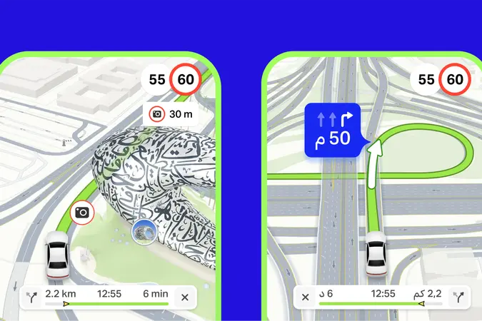
Yango Maps presents a true-to-life depiction of Dubai, with roads, buildings, underground crossings, and even some natural elements like trees visible on the map. In fact, the roads are displayed exactly how you see them in reality: over 3,000 km of roads in Dubai have been mapped out in high detail, reflecting lane markings, multi-level interchanges, tunnels, traffic lights, parking spots, and more. The app also introduces an adaptive view of the route, which highlights important details of the road up ahead and zooms in on complicated turns for safer, well-informed driving.
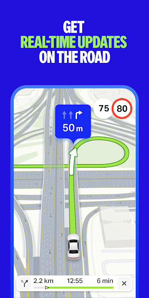
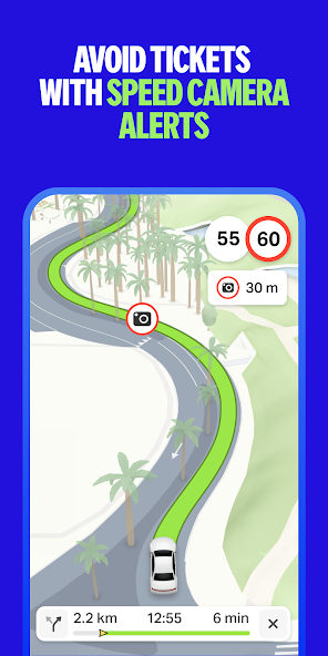

Yango Maps also provides real-time traffic updates in addition to speed limit alerts that are voiced in advance. When the destination is a department store, a business center, or a place in a popular district, Yango Maps displays nearby parking options before the user starts driving so they can plan a route straight to a parking spot.
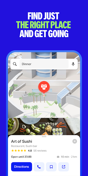
Yango Maps also has useful features for those not in the driver’s seat. Users can book rides via the built-in Yango ride-hailing service, check relevant bus schedules, and travel along streamlined walking routes. That makes it convenient to navigate the city on any mode of transport. As well, finding new, interesting places to explore is as easy as typing the location name in the search box.
Yango Maps displays iconic Dubai landmarks in full-color 3D, including Burj Khalifa, Dubai Frame, the Museum of The Future, and the Jumeirah Mosque. Switching to dark mode triggers lifelike lighting effects on the 3D models, realistically replicating the city’s evening ambience.